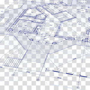
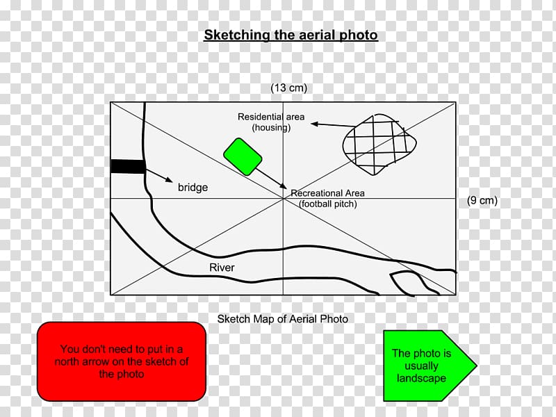
Aerial Map Drawing Ordnance Survey Sketch, aerial view transparent background PNG clipart
Keywords
- aerial
- map
- drawing
- ordnance
- survey
- sketch
- view
- angle
- text
- triangle
- plan
- plot
- parallel
- industrial Design
- point
- travel World
- paper
- ordnance Survey
- line
- area
- circle
- diagram
- document
- geography
- green
- grid Reference
- junior Certificate
- aerial Photography
PNG Clipart Information
- PNG Dimensions 960x720px
- PNG File size 47.3KB
- MIME type Image/png
- PNG dominant color white
License
HiClipart is an open community for users to share PNG images, all PNG cliparts in HiClipart are for Non-Commercial Use, no attribution required. If you are the author and find this PNG is shared without your permisson, DMCA report please Contact Us.
Related PNG clipart images
-

Technology Euclidean Grid, Gray technology grid background, half round gray illustration transparent background PNG clipart -

spherical grid illustration, Globe Grid World map Meridian, sphere transparent background PNG clipart - Advertisements
-

gray world map , Globe World map Dot distribution map, class transparent background PNG clipart -

World map Dot distribution map Globe, dotted line transparent background PNG clipart -

Globe Grid Latitude , wire transparent background PNG clipart -

Light Line Blue Transparency and translucency, Blue technology connection map, shining diamond illustration transparent background PNG clipart -

Paper Google Map Maker Computer Icons World map, location icon transparent background PNG clipart -

Rule of thirds Composition Grid, others transparent background PNG clipart -

Paper plane Airplane Portable Network Graphics , airplane transparent background PNG clipart -

paper plane illustration, Airplane Paper plane , paper plane transparent background PNG clipart -

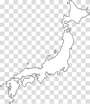
Japan Blank map Physische Karte World map, japan transparent background PNG clipart -

Google Map logo, Google Maps Road map Icon, Paper maps and map pointer transparent background PNG clipart -

Borders and Frames Document , newspaper borders transparent background PNG clipart -

blueprint illustration, Floor plan House plan Architectural plan, Plan transparent background PNG clipart -

world map illustration, Globe World map Map, Map transparent background PNG clipart -

white and black U.S.A. map illustration, Blank map Western United States Border World map, USA transparent background PNG clipart -

blue and green map illustration, Cartoon Map Euclidean , Tourist map map transparent background PNG clipart -

black, gray, and white , Grid Line, Grid lines transparent background PNG clipart -

United States Blank map U.S. state , USA transparent background PNG clipart -

Template Calendar Document Organization Planning, calendar transparent background PNG clipart -

white argyle pattern, Geometry Minimalism Art Geometric design, diamond shape transparent background PNG clipart -

Ribbon Web banner Bias tape Psd, ribbon transparent background PNG clipart -

United States Computer Icons Google Maps, location icon transparent background PNG clipart -

United States Blank map , about us transparent background PNG clipart -

blue map illustration, Flag of Indonesia Map, indonesia transparent background PNG clipart -

Black and white Ink, Black and white scratches, black scribble transparent background PNG clipart -

Technology Euclidean , Blue Line border, blue lines transparent background PNG clipart -

mathematical equations illustration, Mathematics Formula Equation Mathematical notation, Mathematics transparent background PNG clipart -

white paper kite , Airplane Paper plane, dotted line transparent background PNG clipart -

Infographic Circle Icon, Circles and triangles infographics PPT, 01-05 text transparent background PNG clipart -

roman numerals illustration, Clock face Roman numerals Time , time transparent background PNG clipart -

Map Pin Icon, Google Maps, Globe, Location, World Map, Google Map Maker, Google Maps Pin, Symbol transparent background PNG clipart -

abstract painting, Paper Tree Scrapbooking Drawing, plan transparent background PNG clipart -

Simple white earth transparent background PNG clipart -

Philippine mop illustration, Philippines Map , map transparent background PNG clipart -

Black and white Monochrome , Black and white scratches transparent background PNG clipart -

Globe Early world maps, dots transparent background PNG clipart -

Globe World , science wireframe transparent background PNG clipart -

Youtube logo, Paper Black and white Logo Pattern, Youtube Play Button transparent background PNG clipart -

Black and white Square Area, Paper shadow projection angle transparent background PNG clipart -

Europe Blank map World map Mapa polityczna, europe and the united states frame transparent background PNG clipart -

map marker icon, Google Map Maker Google Maps , map marker transparent background PNG clipart -

Triangle Black and white Pattern, Blue Technology Triangle, black graphic transparent background PNG clipart -

Computer network Computer Icons Internet of Things Digital data, industry transparent background PNG clipart -

Printing and writing paper Ruled paper Template, Writing Line s transparent background PNG clipart -

States and territories of India Blank map Mapa polityczna, indian map transparent background PNG clipart -

black line abstract on blue background, Triangle Point Geometric shape Area, Straight line and point connection lines transparent background PNG clipart -

red, white, and blue country map , Flag of Thailand Map, thailand transparent background PNG clipart -

Equilateral triangle Shape Equiangular polygon, free creative triangle buckle transparent background PNG clipart -

black frame illustration, Microsoft Word , cute border transparent background PNG clipart -

black map , Tamil Nadu Map Taxi, india map transparent background PNG clipart -

Musical note Musical notation Sheet music Staff, Music notes transparent background PNG clipart -

Regions of Italy Map Flag of Italy , map transparent background PNG clipart -

map of the Philippines art, Flag of the Philippines Map Flag of the Philippines, philippines transparent background PNG clipart -

Borders and Frames frame Decorative arts , French gorgeous border high-definition map, 3D frame transparent background PNG clipart -

White, Fog smoke white gas effect transparent background PNG clipart -

black compass logo, Compass rose , gps logo transparent background PNG clipart -

Queensland Blank map World map, map of new zealand transparent background PNG clipart -

Technology Euclidean , Technology background, black illustration transparent background PNG clipart -

s illustration, Paper Rope Computer file, Hanging paper transparent background PNG clipart -

Black and white Geometry Geometric abstraction Pattern, Technology Triangle Cover, black and gray hexagonal screenshot transparent background PNG clipart -

Compass rose Geography Cardinal direction North, compass transparent background PNG clipart -

New Zealand Blank map World map Physische Karte, papua new guinea transparent background PNG clipart -

blue sphere art, Point Line Ball Circle, Blue technology road map transparent background PNG clipart -

Paper Origami Ribbon, Origami red ribbon, red illustration transparent background PNG clipart -

white illustration, Point Angle Black and white Pattern, Technology Line transparent background PNG clipart -

google map logo, Google Map Maker Google Maps Marker pen , PLACES transparent background PNG clipart -

map illustration, South America Latin America Blank map Central America, map transparent background PNG clipart -

illustration of people , Computer network Business networking Computer Icons Infographic, connection transparent background PNG clipart -

Line Triangle Circle Point, hud transparent background PNG clipart -

Globe World , Global transparent background PNG clipart -

hand drawn arrow, assorted-arrow art transparent background PNG clipart -

Flag of Japan Map , japan transparent background PNG clipart -

Visayas Luzon Drawing Flag of the Philippines Map, map transparent background PNG clipart -

California Blank map , california transparent background PNG clipart
