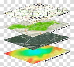
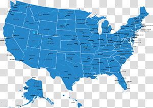
Map, Open Geospatial Consortium, Styled Layer Descriptor, Cartography, Geographic Data And Information, Technical Standard, Interoperability, Implementation transparent background PNG clipart
Keywords
- open
- geospatial
- styled
- layer
- descriptor
- geographic
- data
- information
- technical
- standard
- Open Geospatial Consortium
- Map
- Styled Layer Descriptor
- Cartography
- Geographic Data And Information
- Technical Standard
- Interoperability
- Implementation
- Character Encoding
- Specification
- Consortium
- White
- Text
- Line
- Line Art
PNG Clipart Information
- PNG Dimensions 1276x970px
- PNG File size 550.04KB
- MIME type Image/png
- PNG dominant color gray
License
HiClipart is an open community for users to share PNG images, all PNG cliparts in HiClipart are for Non-Commercial Use, no attribution required. If you are the author and find this PNG is shared without your permisson, DMCA report please Contact Us.
Related PNG clipart images
-

GeoServer Heat map Styled Layer Descriptor Raster graphics, others transparent background PNG clipart -

Geographic Information System Geography GIS Day Geographic data and information, layer transparent background PNG clipart - Advertisements
-

black compass logo, Compass rose , gps logo transparent background PNG clipart -

Geographic Information System Mastering ArcGIS Geography Geographic data and information, map transparent background PNG clipart -

Map, Information System, Geography, Geographic Information Science, Geographic Data And Information, Web Mapping, Cartography, Information Technology transparent background PNG clipart -

Geographic Information System Computer Icons Map Icon design, map transparent background PNG clipart -

World map Dot distribution map Globe, dotted line transparent background PNG clipart -

Wisconsin Blank map , State transparent background PNG clipart -

assorted-color boards , Chart Infographic Information, PPT Chart transparent background PNG clipart -

Grunge Texture mapping, grunge texture transparent background PNG clipart -

gray map illustration, Flag of Indonesia Map, map transparent background PNG clipart -

Green Grass, Openapi Specification, Open Api, Web Api, Representational State Transfer, Swagger, Overview Of Restful Api Description Languages, Interface transparent background PNG clipart -

Geographic Information System Map Geography Open Geospatial Consortium, Geographic Data And Information transparent background PNG clipart -

OpenStreetMap JOSM Geographic Information System Geographic data and information, road map infography aerial view transparent background PNG clipart -

Geographic Information System Map Open Geospatial Consortium Computer Software Geospatial analysis, map transparent background PNG clipart -

Geographic Information System GIS Day GIS applications Map Geography, cartoon earth transparent background PNG clipart -

Computer Icons Geographic Information System Icon design, map icon transparent background PNG clipart -

Federal government of the United States Map U.S. state, USA transparent background PNG clipart -

Geographic Information System Computer Icons Map Geographic data and information Computer Software, map transparent background PNG clipart -

Treasure map Treasure hunting Piracy, map transparent background PNG clipart -

JOSM OpenStreetMap OpenHistoricalMap Open Source Geospatial Foundation, map transparent background PNG clipart -

ISO/IEC 27001 International Organization for Standardization Company ISO 9000, egypt cultural developments transparent background PNG clipart -

North Compass rose Symbol graphics, compass transparent background PNG clipart -

Globe Map projection Cartography International Cartographic Association International Geographical Union, World map decorative pattern transparent background PNG clipart -

Blank map Zagreb Drawing Geography, Croatia map transparent background PNG clipart -

Evaluation Company Payment Card Industry Data Security Standard Management Regulatory compliance, definition transparent background PNG clipart -

Wind rose Compass rose Points of the compass, compas rose wid transparent background PNG clipart -

Google Map Maker Computer Icons Information, location icon transparent background PNG clipart -

Bible , others transparent background PNG clipart -

brain with neurons , Mind map , Cartoon brain thinking divergent color tree transparent background PNG clipart -

Signature Handwriting Letter, Signature transparent background PNG clipart -

Chinese dragon, Dragon transparent background PNG clipart -

Globally Harmonized System of Classification and Labelling of Chemicals Hazard Communication Standard Safety data sheet Workplace Hazardous Materials Information System, others transparent background PNG clipart -

Spain Computer Icons Map Geography Spatial data infrastructure, map transparent background PNG clipart -

San Francisco Flottsbro Open data holm Management, map icon transparent background PNG clipart -

Wave dash Tilde Unicode Shift JIS, curved line transparent background PNG clipart -

Aurangabad Toronto Location Business Map, Map with landmarks material ed transparent background PNG clipart -

Computer Icons Road map Research question , map transparent background PNG clipart -

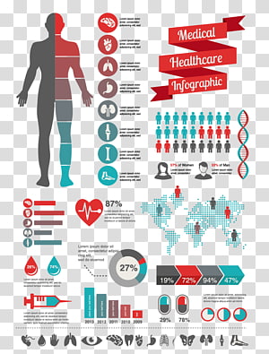
Infographic Health Care Medicine , Information relating to medical data map transparent background PNG clipart -

Map, Information System, Geography, Data, Gis Solutions Inc, Web Mapping, Geographic Data And Information, Business transparent background PNG clipart -

GPS Navigation Systems Computer Icons , gps transparent background PNG clipart -

ISO 9000 Quality assurance Quality management International Organization for Standardization, iso 9001 transparent background PNG clipart -

Vertical bar Character , straight line transparent background PNG clipart -

Liaoyang Road map Map City map, map exquisite graphics painting transparent background PNG clipart -

Road map Himachal Pradesh Punjab Geographic Information System, india map transparent background PNG clipart -

gray art workds, Information Icon, European lace dividing line transparent background PNG clipart -

International Standard Serial Number Global Trade Item Number International Article Number Barcode Publication, barcode transparent background PNG clipart -

compass illustration, Compass rose Simple English Wikipedia North , magnet transparent background PNG clipart -

World Geographic data and information System Globe, globe transparent background PNG clipart -

Singapore Map, SINGAPORE transparent background PNG clipart -

GRASS GIS Geographic Information System Open Source Geospatial Foundation Free and open-source software Geospatial analysis, fair and just transparent background PNG clipart -

Marketing Management , Advertising Digital marketing Content marketing, Marketing Plan transparent background PNG clipart -

Data Matrix Barcode 2D-Code, matrix code transparent background PNG clipart -

Mercator projection Map Computer Icons Symbol , Mountain transparent background PNG clipart -

Globe Flat Earth World map, globe transparent background PNG clipart -

Location Computer Icons Saphex 2018 Map Gallagher Convention Centre, map transparent background PNG clipart -

Wales Blank map Coast Hydrography, map transparent background PNG clipart -

North Compass rose Cardinal direction , compass transparent background PNG clipart -

Indonesia Philippines World map, indonesia map transparent background PNG clipart -

QGIS Geographic Information System Computer Software Free software, others transparent background PNG clipart -

Compass rose North , compass elements transparent background PNG clipart -

Indonesian presidential election, 2004 Map Geography, map transparent background PNG clipart -

Sweden flag, Flag of Denmark Map , Jewish Holidays transparent background PNG clipart -

Blackjack Playing card Card game, Jack card transparent background PNG clipart -

yellow floral decor, Embroidery Gold Cutwork Ornament Information, embroidery transparent background PNG clipart -

Indonesian National Revolution Flag of Indonesia Map Pembela Tanah Air, map transparent background PNG clipart -

black and white Goth font text, Tattoo Typeface Lettering Font editor Font, Thug Life transparent background PNG clipart -

Organic food Soil Association Organic certification Organic farming, soil transparent background PNG clipart -

chess game set, Balanced scorecard Strategy map Management, Chess Illustration transparent background PNG clipart -

Computer Icons Map GPS Navigation Systems Road, path transparent background PNG clipart -

Data entry clerk Information technology Computer Icons, Data entry transparent background PNG clipart -

story book illustration, Euclidean , Book of pirate world illustration transparent background PNG clipart -

Mind map Computer Icons , map transparent background PNG clipart -

Silverstone Circuit Formula One Information Diagram , united kingdom transparent background PNG clipart
