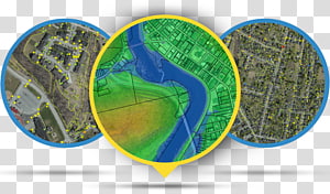
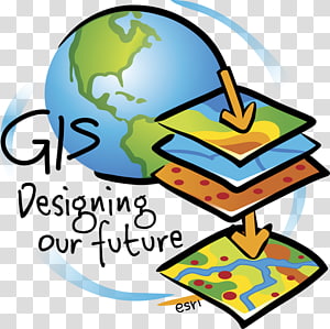
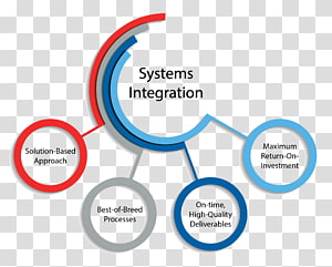
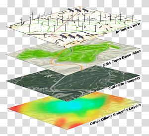
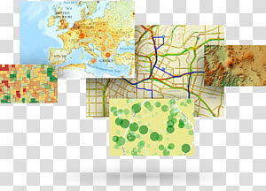
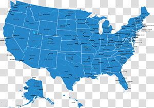
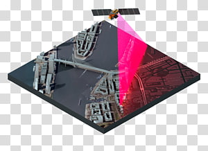
Open Geospatial Consortium Geographic data and information Web mapping Geospatial analysis Geographic Information System, map transparent background PNG clipart

Keywords
- open
- geospatial
- consortium
- geographic
- data
- information
- web
- mapping
- analysis
- system
- map
- blue
- text
- trademark
- logo
- engineer
- number
- technical Standard
- geographic Data And Information
- geospatial Analysis
- symbol
- organization
- travel World
- open Geospatial Consortium
- web Map Service
- ogc
- aviation
- brand
- esri
- geographic Information System
- line
- area
- web Mapping
PNG Clipart Information
- PNG Dimensions 4200x1800px
- PNG File size 335.5KB
- MIME type Image/png
- PNG dominant color blue
License
HiClipart is an open community for users to share PNG images, all PNG cliparts in HiClipart are for Non-Commercial Use, no attribution required. If you are the author and find this PNG is shared without your permisson, DMCA report please Contact Us.
Related PNG clipart images
-

earth illustration, Geographic Information System GIS Day Geographic data and information Geography Map, Earth In transparent background PNG clipart -

planet earth artwork, Esri ArcGIS Server Geographic Information System Computer Software, previous icon transparent background PNG clipart - Advertisements
-

Geographic Information System Geography Geospatial analysis Map, map transparent background PNG clipart -

Geographic Information System Mastering ArcGIS Geography Geographic data and information, map transparent background PNG clipart -

Big data Data analysis Analytics, Business transparent background PNG clipart -

Big data Analytics Data analysis Data visualization, internet of things transparent background PNG clipart -

assorted-color boards , Chart Infographic Information, PPT Chart transparent background PNG clipart -

Map, ArcGIS, Web Map Service, Web Mapping, Esri, Geography, Qgis, Digital Mapping, Geographic Data And Information, Information System transparent background PNG clipart -

WWW logo, Logo Web page, world wide web transparent background PNG clipart -

Report Analysis Chart Analytics Management, analyst transparent background PNG clipart -

Geographic Information System Computer Icons Map Icon design, map transparent background PNG clipart -

System integration Technology Information Consultant, technology transparent background PNG clipart -

ISO 9000 Certification ISO 9001:2015 AS9100 International Organization for Standardization, Business transparent background PNG clipart -

Esri ArcGIS Server Geographic Information System ArcMap, map transparent background PNG clipart -

ISO 9000 ISO 9001:2015 International Organization for Standardization Quality management system, Business transparent background PNG clipart -

Geographic Information System Geography GIS Day Geographic data and information, layer transparent background PNG clipart -

blue check , Computer Icons Quality control Quality management, quality transparent background PNG clipart -

System integration Business Integral E-commerce, tech transparent background PNG clipart -

Business intelligence software Business analytics, Business transparent background PNG clipart -

Data analysis Analytics Business intelligence Computer Icons, data analytics transparent background PNG clipart -

Web development Computer Icons, world wide web transparent background PNG clipart -

Geographic Information System Computer Icons Map Geographic data and information Computer Software, map transparent background PNG clipart -

ArcGIS ArcView Esri ArcEditor ArcInfo, map transparent background PNG clipart -

eyeglass, paper, pencil, and calculator , Data analysis Big data Management Data processing, report transparent background PNG clipart -

Wisconsin Blank map , State transparent background PNG clipart -

Web development HTML CSS3 The Ohana Code Logo, 2cpaper projection shaded_1660937.html/dropdown.js transparent background PNG clipart -

Web development Computer Icons, website transparent background PNG clipart -

Server Logo, ArcGIS, Esri, Geographic Data And Information, Esri Canada, Arcgis Server, Computer Software, Geography transparent background PNG clipart -

magnifying glass and gear illustration, Web analytics Big data Data analysis, Seo Analytics transparent background PNG clipart -

phone repair illustration, Information technology Managed services Technical Support IT infrastructure, Blue technology transparent background PNG clipart -

Logo Computer Icons , INSTAGRAM LOGO, Instagram logo transparent background PNG clipart -

WordPress Logo Theme, WordPress transparent background PNG clipart -

24/7 service illustration, 24/7 service Handyman Los Angeles Customer Service, twenty-four transparent background PNG clipart -

Registered trademark symbol Copyright, copyright transparent background PNG clipart -

white house illustration, Home page Computer Icons Website World Wide Web, Blue Home Page Icon transparent background PNG clipart -

Data management Organization Data governance Business, management transparent background PNG clipart -

Computer Icons Portable Network Graphics Telegram Business Partnership, telegram Icon transparent background PNG clipart -

orange, blue, and black logo, Logo Circle Technology , circle transparent background PNG clipart -

blue phone inside circle icon, Telephone call Symbol Smartphone Ringing, phone transparent background PNG clipart -

Treasure map Treasure hunting Piracy, map transparent background PNG clipart -

Web development HTML Logo World Wide Web Consortium, Create Html Signature transparent background PNG clipart -

Scalable Graphics JavaScript Encapsulated PostScript , javascript logo transparent background PNG clipart -

white and green map , Nigeria Web mapping Globe , eva longoria transparent background PNG clipart -

Beyeler Foundation GPS Navigation Systems Computer Icons Google Map Maker, map marker transparent background PNG clipart -

Mobile Phones Computer Icons Telephone Prepay mobile phone Business, Mobile Phone Icon Phone, Telephone Icon, call icon transparent background PNG clipart -

blue map illustration, Flag of Indonesia Map, indonesia transparent background PNG clipart -

Data science Analytics Data analysis Big data, technology transparent background PNG clipart -

United States Computer Icons Google Maps, location icon transparent background PNG clipart -

Heart Symbol, ArcGIS, Esri, Arcmap, Data, Computer Software, Organization, Web Map Service transparent background PNG clipart -

round blue, green, and brown , Big data Analytics Data visualization, data analytics transparent background PNG clipart -

1 2 3 4 5 text overlay, Chart, Creative PPT element transparent background PNG clipart -

E logo, SPSS Modeler IBM Data analysis Statistics, ibm transparent background PNG clipart -

Information technology Information and Communications Technology Industry, technology transparent background PNG clipart -

Website development World Wide Web Internet Computer Icons Web standards, Government Services transparent background PNG clipart -

Registered trademark symbol Service mark Copyright, r transparent background PNG clipart -

Layers Web Feature Service Web Map Service, layer transparent background PNG clipart -

not to do sign art, Health Care Computer Icons Information Business, cancel button transparent background PNG clipart -

google map logo, Google Map Maker Google Maps Marker pen , PLACES transparent background PNG clipart -

Facebook Messenger Logo Icon, Facebook , Facebook logo transparent background PNG clipart -

Discounts and allowances Online shopping Sales Service Coupon, 20 transparent background PNG clipart -

Computer Icons Web design, world wide web transparent background PNG clipart -

magnifying glass illustration , Computer Icons Data analysis Business Organization, analysis transparent background PNG clipart -

Computer Icons Technical Support 24/7 service Managed services, others transparent background PNG clipart -

Logo International Organization for Standardization ISO 9000 ISO 13485, iso 9001 transparent background PNG clipart -

Federal government of the United States Map U.S. state, USA transparent background PNG clipart -

facebook logo, Facebook Computer Icons Desktop , s Icon Facebook transparent background PNG clipart -

Information Computer Icons , information transparent background PNG clipart -

profile icon, User Computer Icons System, chinese wind title column transparent background PNG clipart -

end call logo, Telephone number Email Telephone call Payphone, TELEFONO transparent background PNG clipart -

Dashboard Analytics Data analysis Information Business intelligence, data analytics icons transparent background PNG clipart -

location icon, Google Maps Computer Icons GPS Navigation Systems Google Map Maker, map transparent background PNG clipart -

ArcGIS Geographic Information System Esri Cartography, map transparent background PNG clipart -

Marketing, Competitor Analysis, Market Research, Marketing Research, Market Analysis, Data Analysis, Competition, Business transparent background PNG clipart -

Rubber stamp , open now transparent background PNG clipart -

MySQL logo, MySQL Database Web development Computer Software, dolphin transparent background PNG clipart
